Modern System Used by the Firefighters. Satellites and Drones Helpful in Flood Prevention

Data provided by drones and satellites, along with a modern system for integration of innovative tools are just some of the solutions that the firefighters had at their disposal, during the “FALA 2018” rescue exercise. All of the above was provided thanks and via the SAFEDAM system developed by the Polish engineers. The system has met a positive reception and it stands a chance of being implemented at institutions and within services responsible for crisis management.
One System, Numerous Merits
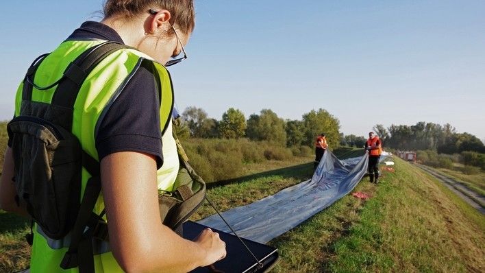
“Fala 2018” exercise took place between 19th and 21st September in the Radom and Kozienice districts (Powiats). The operation involved several hundred firemen who were participating in execution of tasks related to flood threat prevention. The rescue operation was being supported by SAFEDAM which is an innovative system for monitoring the status of flood embankments. It was developed by a team of Polish engineers. The system provided the firemen with up to date data on the potential flood threat. It also made it possible to ensure real time data transfer to the crisis management authorities, via a drone-captured video-stream. Thanks to a mobile hardware package running the SAFEDAM system the updated location of the individual units of the fire service was being monitored, in an ongoing manner, by the exercise directing team.
SAFEDAM System has met a positive appraisal on the part of the firemen participating in the exercise. The solutions currently used by the State Fire service are very much scattered, while SAFEDAM offers access to numerous functionalities and databases within a single, integrated system which makes it possible to manage the rescue operations in a better and quicker manner. The system also allows the society to get involved in the flood prevention. Thanks to a dedicated mobile application anybody can send a submission concerning the flood threat noticed, enclosing photos and movies from the event site.
Satellite Data Available in 3 Hours
During the exercise, a Pleiades satellite belonging to the Airbus Defence and Space company took a high-resolution photograph of the exercise area, with that photograph being imported into the SAFEDAM database 3 hours later.
The satellite imagery remains the only source of information that could be obtained in such a short time, for a vast area. In this case, we are referring to an area of 100 squared kilometres. Thanks to the above, the services working within the flood-affected area may have a homogeneous and up to date imagery of a large area at their disposal, allowing them to effectively assess the current situation.
SAFEDAM is an innovative system for monitoring the status of flood embankments with the use of satellite data and non-invasive unmanned aerial platforms equipped with visible light/IR spectra cameras. Thanks to the above the system makes it possible to work 24 hours a day, on location where the danger of flooding may emerge. Apart from the access to the national surveying and cartographic resources, SAFEDAM also makes it possible to easily and quickly access current data, including freshly acquired satellite imagery both from the freely accessible data, derived from the European Copernicus Earth Observation programme, as well as imagery provided by high resolution commercial data and very high resolution imagery, for instance from the Airbus Defence and Space Pleiades satellite constellation.
At the moment SAFEDAM offers coverage for 6 test areas. The system architecture makes it possible to easily include coverage of further areas if needed. Also, the system is open to importing data from a variety of drones and satellites. SAFEDAM project is being worked on by the following consortium: Faculty of Geodesy and Cartography of the Warsaw University of Technology (leader), Institute of Meteorology and Water Management, Astri Polska, MSP Marcin Szender within the framework of a project financed by the National Centre For Research and Development w as a part of the Security and Defence programme.
August Żywczyk
Source: Astri Polska

WIDEO: Defence24 Days 2025: Premier Defence & Security Conference in CEE